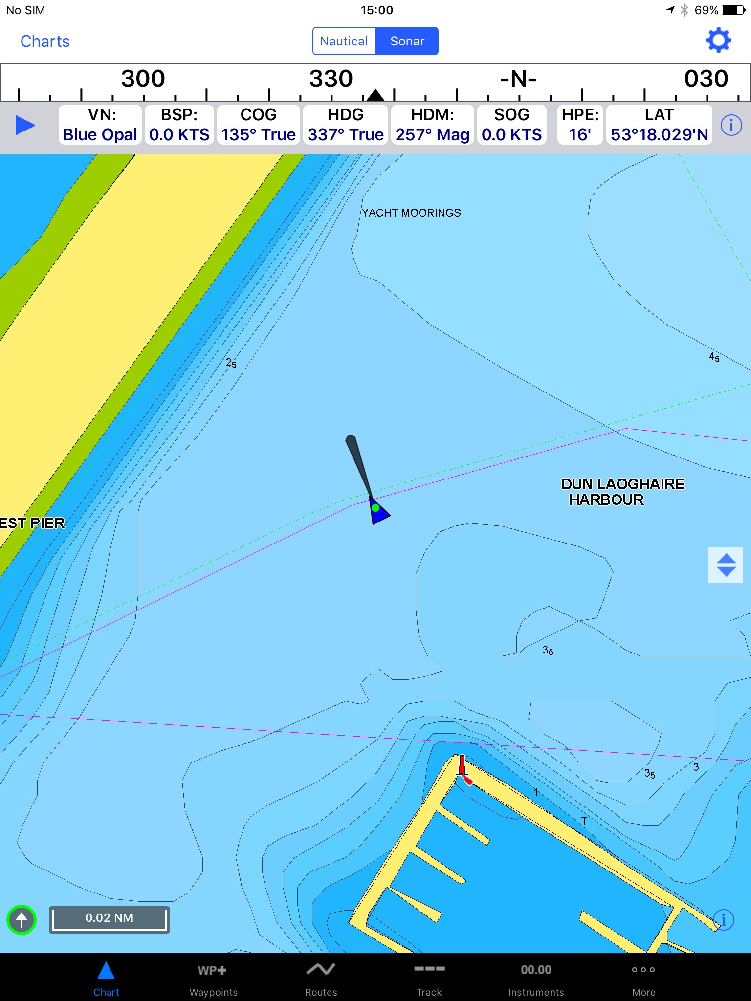
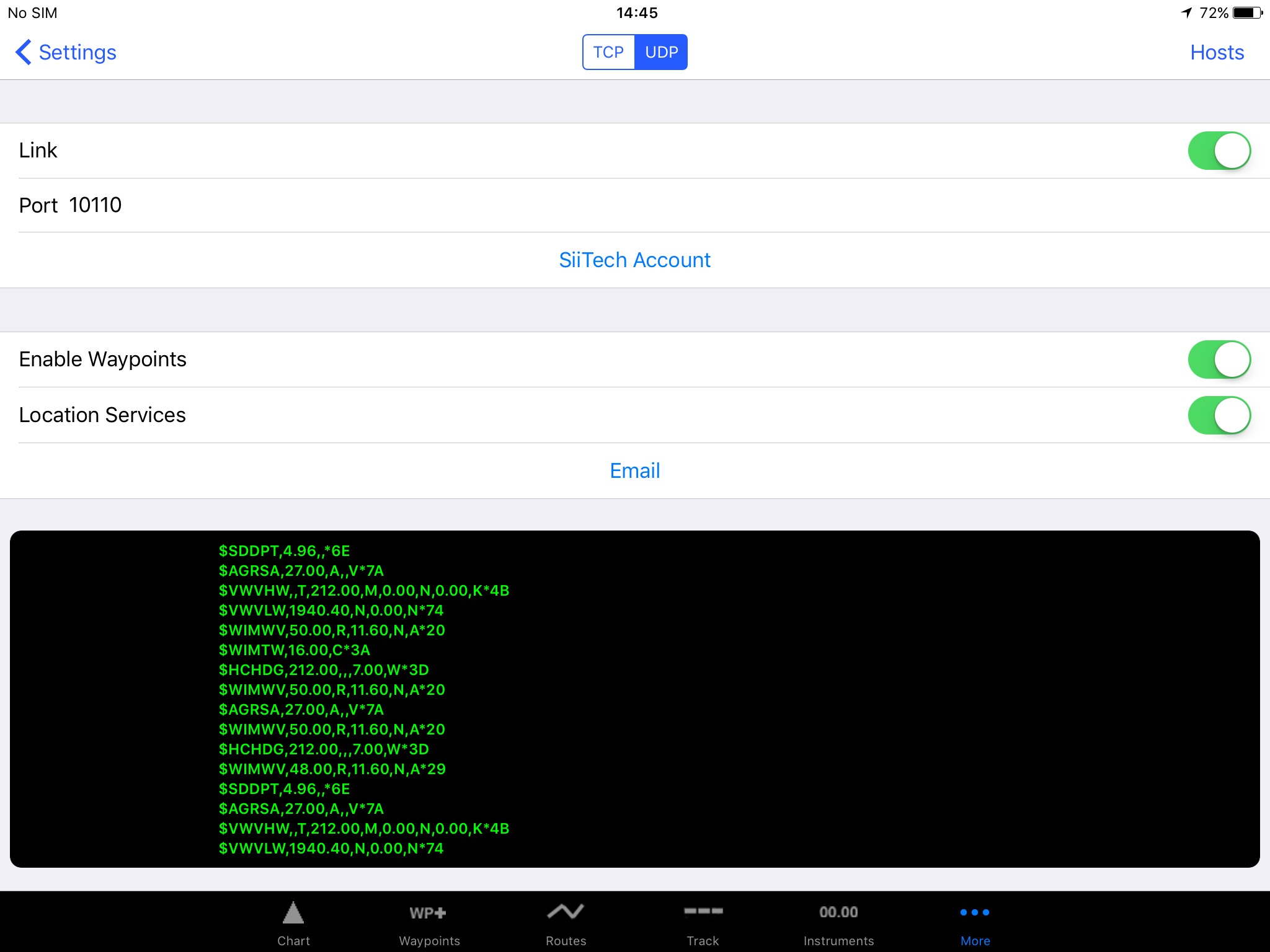
The ShipModul is happily chatting with iNavX on my iPad. Operation success!
It turns out that a few of the Raymarine instruments had NMEA 183 outputs that I could have wired to the NavTex, but that wouldn’t have sorted out getting the data over to something that can behave a bit like a chart plotter. I’ll still have paper charts as a fallback, and it’s likely that any passage making I do will have waypoints on the paper charts, waypoints printed out, and waypoints in iNavX.